Properties
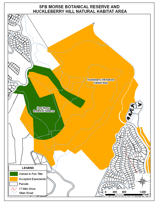
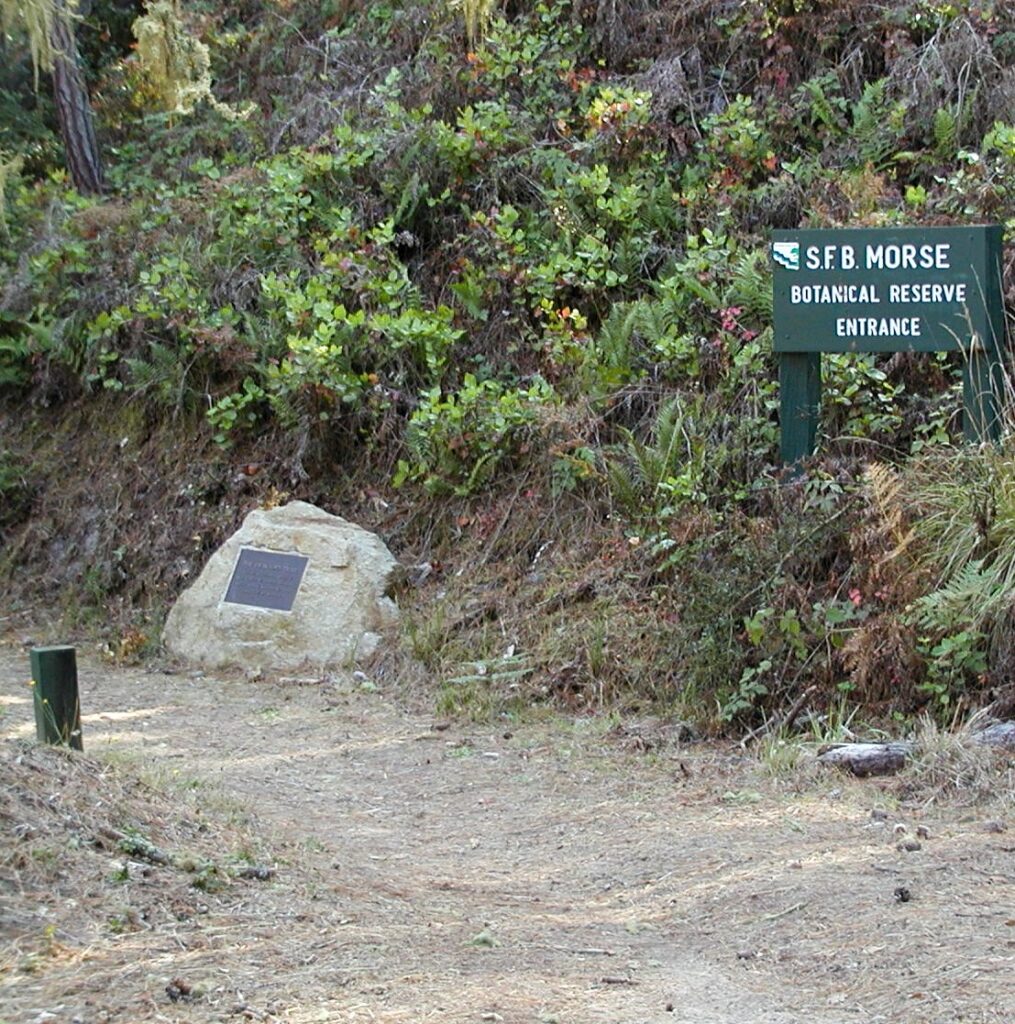
SFB MORSE BOTANICAL RESERVE
SFB Morse Botanical Reserve – 83.94 Acres (2 parcels)
OSAC Category IIA: Protected Natural Resources
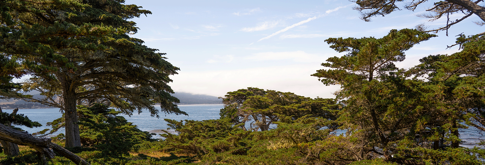
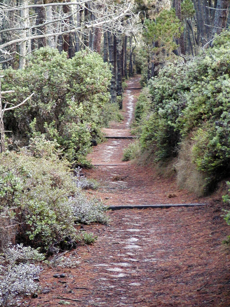
The SFB Morse Botanical Reserve is located within the Gowen Cypress Planning Area in two parcels to the south and east of Congress Road. The SFB Morse Botanical Reserve was established in 1972 to protect the endangered Gowen Cypress, as well as other species or associations of species found only on the acidic clay-pan soils found in this area. Subsequently, other rare and endangered species have been identified in the reserve that includes two principal headwater tributaries of Sawmill Gulch.
The 84 acres of the SFB Morse Botanical Reserve are now adjoined by the 372 acres of the Huckleberry Hill Natural Habitat Area as mandated under the Del Monte Forest Area Land Use Plan of Monterey County’s Local Coastal Program and approved by the Coastal Commission.
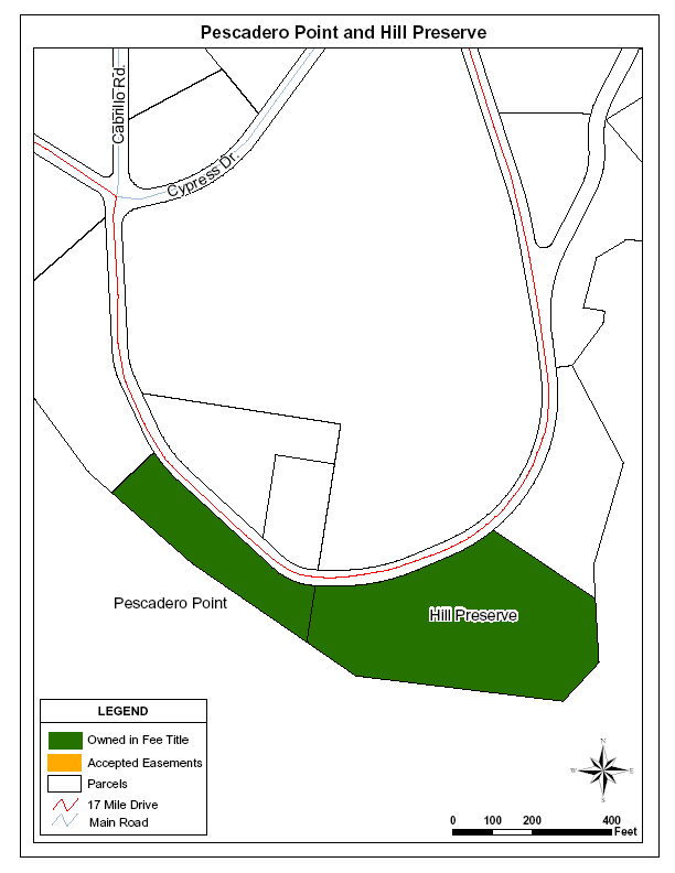
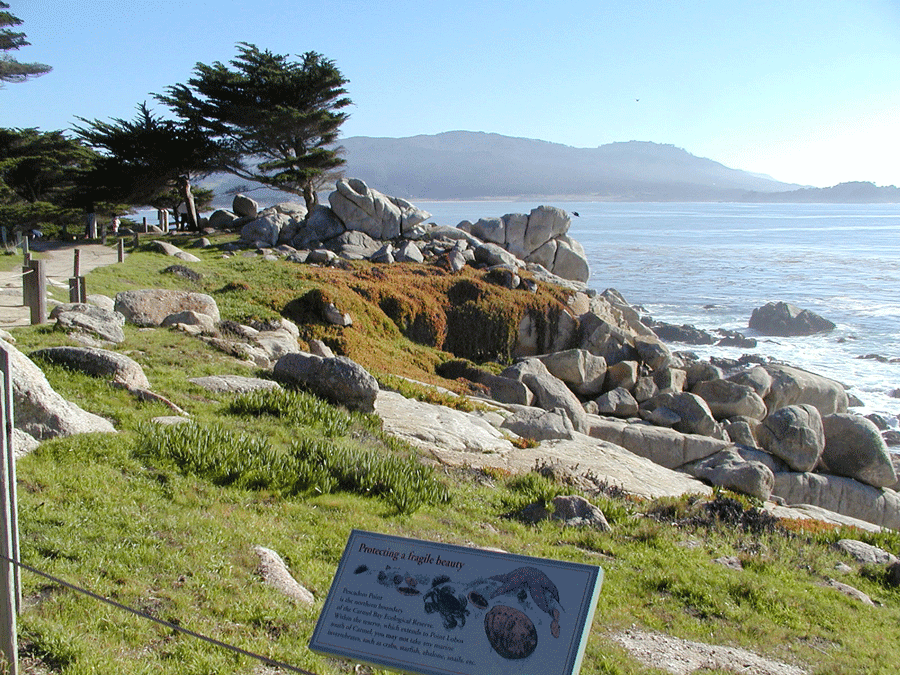
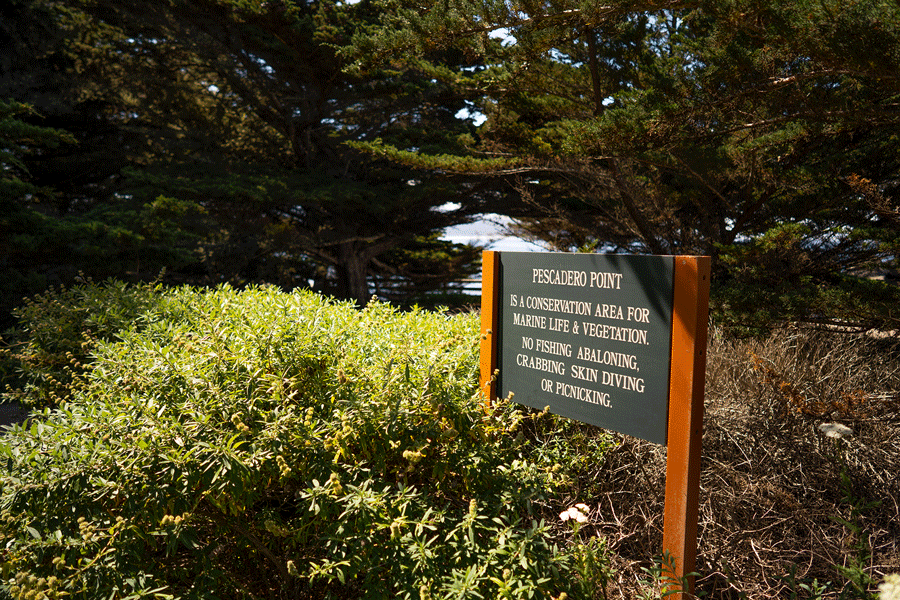
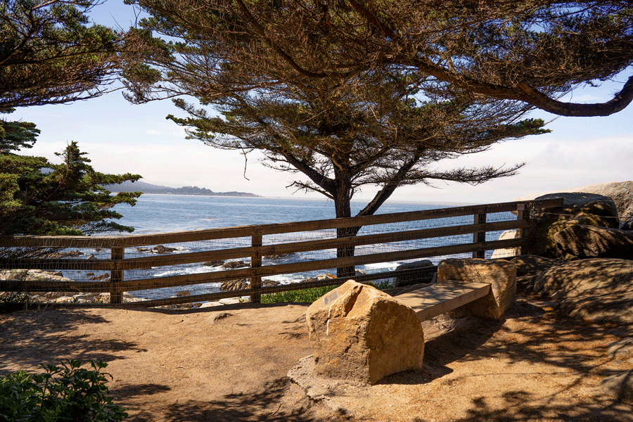

Pescadero Point – 1.61 Acres
OSAC Category 1A: Intensively Used Area
Pescadero Point is located on a promontory between Stillwater Cove and Crocker Cypress Grove. The 1.61-acre Pescadero Point parcel was given to the Monterey Peninsula Foundation in 1958 to be held as open space in perpetuity by Mr. and Mrs. Paul Fagan.
The Monterey Peninsula Foundation transferred the property to DMFC in 1982 in accordance with the recommendations of Open Space Advisory Committee.
This scenic and historic promontory was called Pescadero fishing place by the Spaniards. The Indian middens, containing hundreds of clam and abalone shell fragments, testify that the Ohlones enjoyed this spot long before outsiders came. A famous cypress known as the Witch Tree was a landmark here. No longer standing, its fallen trunk remains roped off in the center of the parcel.
Cortlandt Hill Preserve – 4.8 acres
OSAC Category IIA: Protected Natural Resources and
XI: Rare or Endangered Species
The Cortlandt Preserve is located on Pescadero Point on the coastal bluffs south and east of 17 Mile Drive, immediately east of the Pescadero Point public access turnout. The Cortlandt Hill Preserve was dedicated by the Hill family as permanent open space in 1996. The 4.8-acre parcel had been owned by the Hill family since 1923. Its dedication protects habitat of native Monterey cypress mixed with some Monterey pine set upon a grassy coastal bluff.
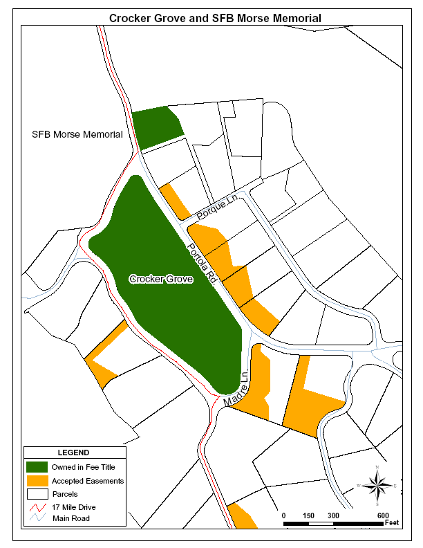
Crocker Grove – 12.54 Acres
OSAC Category IIB: Protected Natural Resources
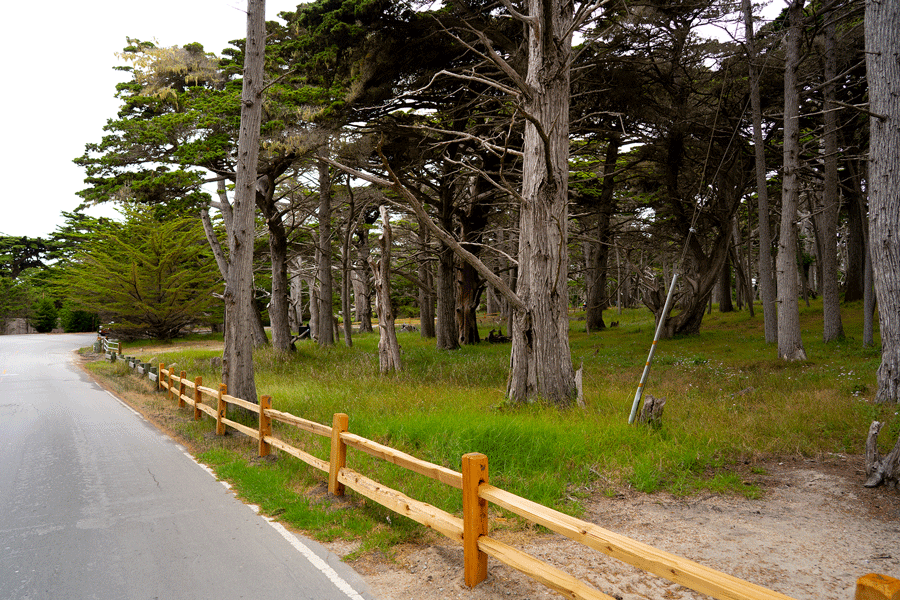
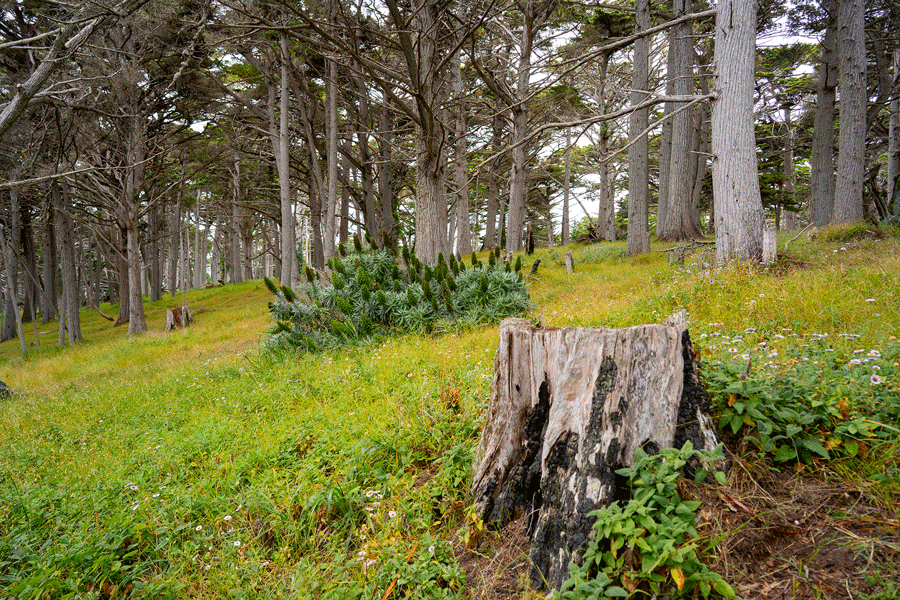
The Crocker Cypress Grove is located near Cypress Point. It is bounded on the north by Portola Road, on the east by Madre Lane and on the south and west by 17 Mile Drive. The Crocker Cypress Grove is a prime example of native, first-growth Monterey cypress forest. Monterey cypress occurs naturally in only two extremely small populations: the northerly population in Pebble Beach that extends from Cypress Point to Pescadero Point, and the southerly population located across Carmel Bay at Point Lobos. Crocker Grove is located in the heart of the northerly native population.
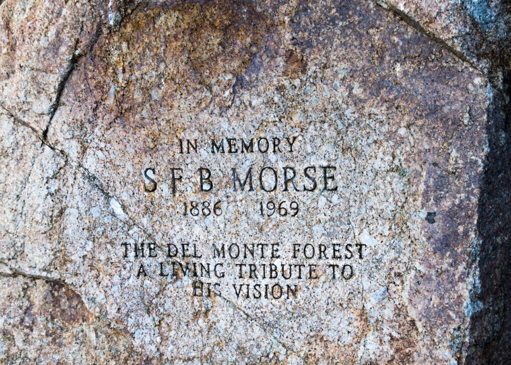
S.F.B. Morse Memorial Lot – 1.25 Acres
OSAC Category IIB: Protected Natural Resources
The S.F.B. Morse Memorial Lot is located along 17 Mile Drive near the first fairway of the Cypress Point Golf Course. Near Crocker Grove and part of the northern population of Monterey cypress, the S.F.B. Morse Memorial is a natural open space containing some old cypress giants. This 1.25-acre tract was transferred from the Monterey Peninsula Foundation to DMFC in 1982.
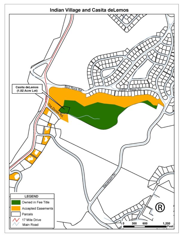
Indian Village – 20.02 Acres
OSAC Category IB: Intensively Used Area and IV: Open Forest
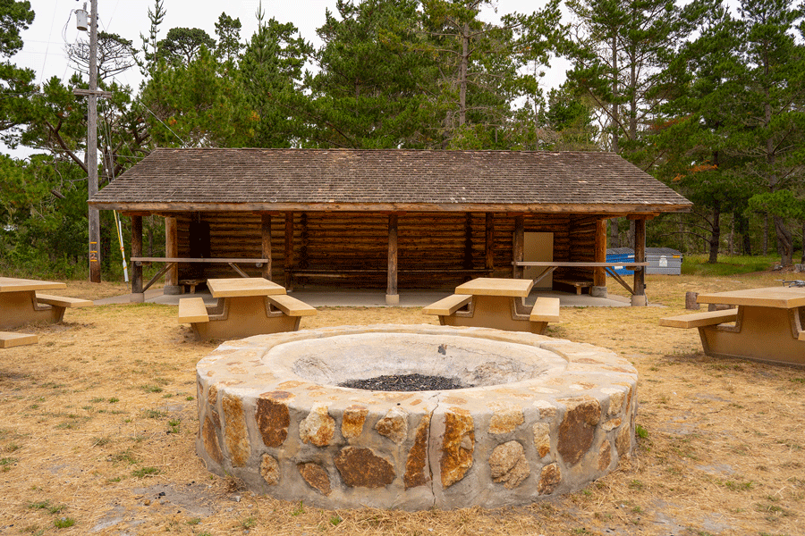
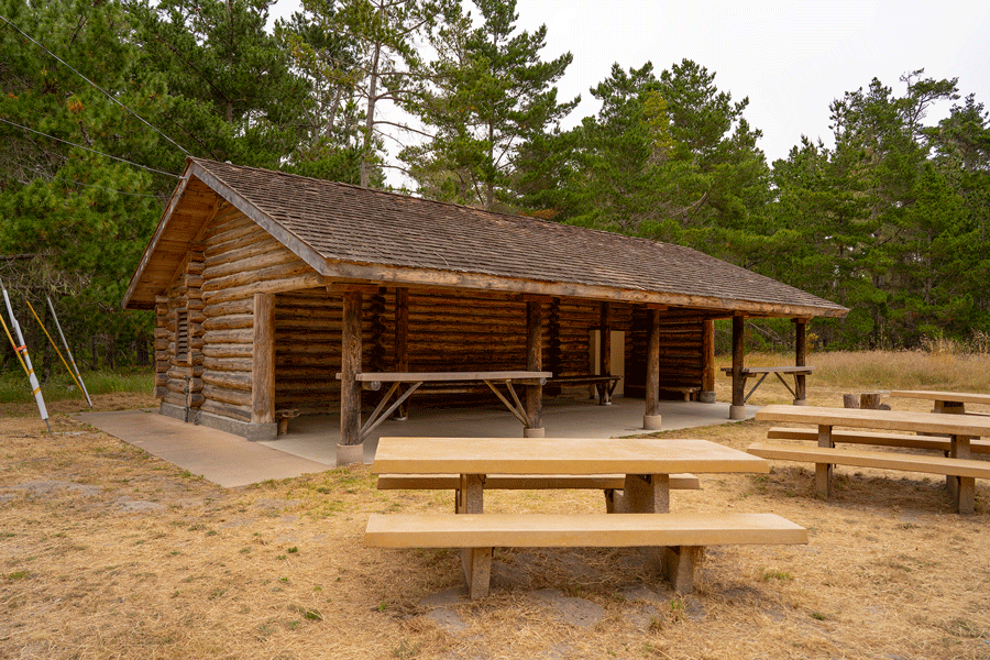
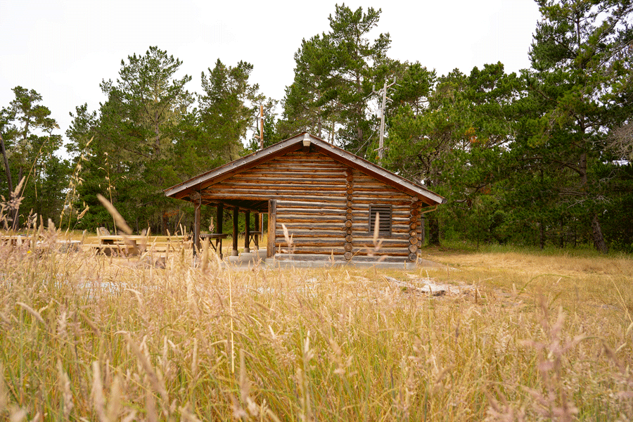
Indian Village is located just inland of 17 Mile Drive at The Dunes Road south of Seal Rock Creek. Indian Village consists of a 20.02-acre parcel of primarily mature Monterey pine forest with a park-like clearing and picnic facilities. Access is by graded dirt road from The Dunes Road. Secondary access is via a hiking/equestrian trail from Stevenson Drive near the seventh green of the Spyglass Hill Golf Course.
Indian Village may be rented by Del Monte Forest residents. Reservations can be made through the Pebble Beach Community Services District office.
Casita de Lemos – 1.02 acres
OSAC Category III: Developed Area;
II, X & XI: Protected Natural Reserves with sensitive habitat and rare or
endangered species in dunes habitat; and
IV: Open Forest east of the residence
Perched high on a sand dune at the entrance to Indian Village is a Forest landmark, the storybook “Hansel and Gretel” cottage known as the Casita de Lemos (or Gingerbread House). DMFC added this 1.02-acre property to Indian Village in 1993, accepting it as a gift from Pebble Beach Company.
The Casita was built in 1944 by Pedro de Lemos as a guest house/studio for a much larger residence planned on the property. The poured concrete roof was hand formed to create the appearance of colored tiles. Due to the owner’s illness, the main residence was never finished, but the original foundation is still visible.
DMFC carried out major renovations on the Casita from 2012 through 2014, restoring the roof tiles once again to original colors, and repurposing many original materials for use throughout the interior and exterior during the renovation. The Casita currently generates rental income to carry out the Conservancy’s mission. DMFC acts as rental property manager.
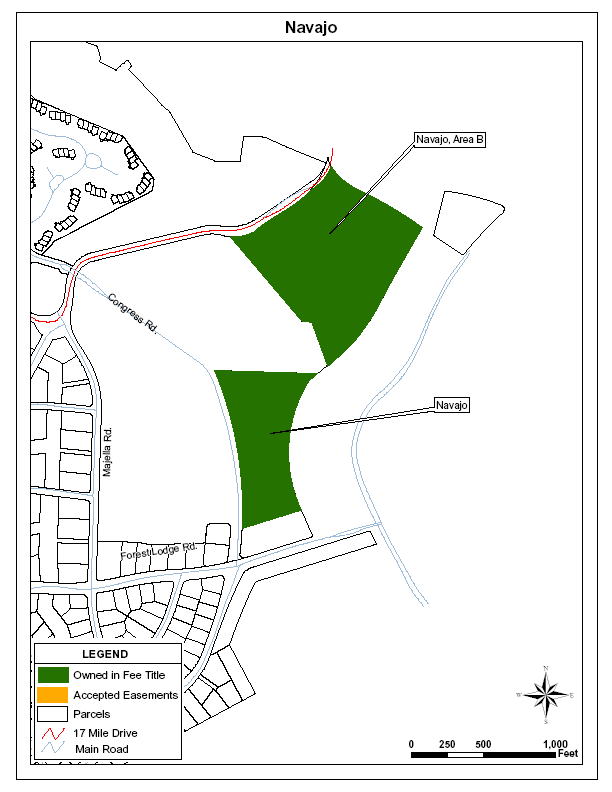
Navajo Tract – 10 Acres
OSAC Category IVB: Open Forest
The Navajo tract is located between the Country Club and Pacific Grove gates at the northern end of the Del Monte Forest. The Navajo tract is a heavily wooded, mixed pine/oak forest. The parcel adjoins a strip of land along Congress Avenue that was sold to the City of Pacific Grove and is now named Van Winkle Park.
The Navajo Tract was part of an old Spanish grant known as Punta de Pinos because of the magnificent Monterey Pines there. The name Navajo seems to stem from the fact that at one time, it belonged to the Navajo Mining Company, a silica mining operation.
Area B (Navajo North) – 15.57 Acres
OSAC Category IVB: Open Forest
Located just north of the original Navajo tract and adjacent to Pacific Grove’s Van Winkle Park, this 15.574-acre parcel was donated to DMFC in 1989 by Pebble Beach Company. This parcel is part of Area B in Monterey County’s Del Monte Forest Area Land Use Plan adopted by the Coastal Commission in 1984, which includes part of the roughly 46 acres of Navajo/Van Winkle Park open space. The description and history of the Navajo tract apply equally well to this parcel.
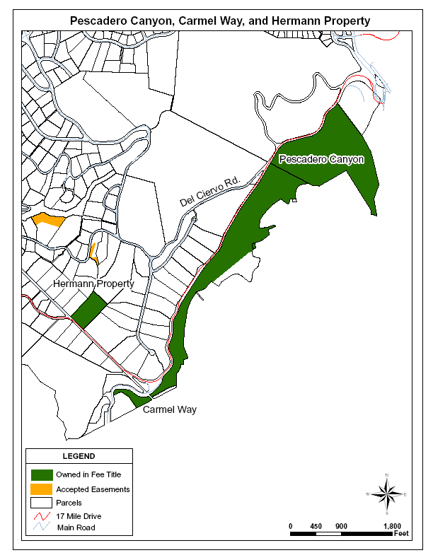
Pescadero Canyon – 1981 Ford Meadow (2 parcels) – 73.474 Acres
OSAC Category IVB: Open Forest
Pescadero Canyon is located at the south and easterly end of the Del Monte Forest. The open space parcel is bounded on the north and west by 17 Mile Drive and on the south and east by the city limit of Carmel-by-the-Sea and residences in the Carmel Woods area. Pescadero Canyon open space consists primarily of the immediate watershed and stream course of Pescadero Creek on the south side of 17 Mile Drive.
Carmel Way – 1.5 Acres
OSAC Category IV: Open Forest, and VIII: Riparian and Wetland.
The Carmel Way parcel is located at the eastern edge of Carmel Way immediately below the Pescadero Canyon parcels and just north of the Carmel Gate along Pescadero Creek. Its dominant native cover is Monterey pine mixed with some coast live oak. Redwood trees planted many years ago along the bottom of Pescadero Creek now dominate much of the creek side on this parcel.
Hermann Property – 4.51 Acres
OSAC Category IVB: Open Forest
The Hermann Property is located along 17 Mile Drive at the intersection with Crespi Lane between the Carmel Gate and Pebble Beach Golf Links. The parcel is dissected by two seasonal watercourses and supports a mixed forest of Monterey pine and coast live oak.
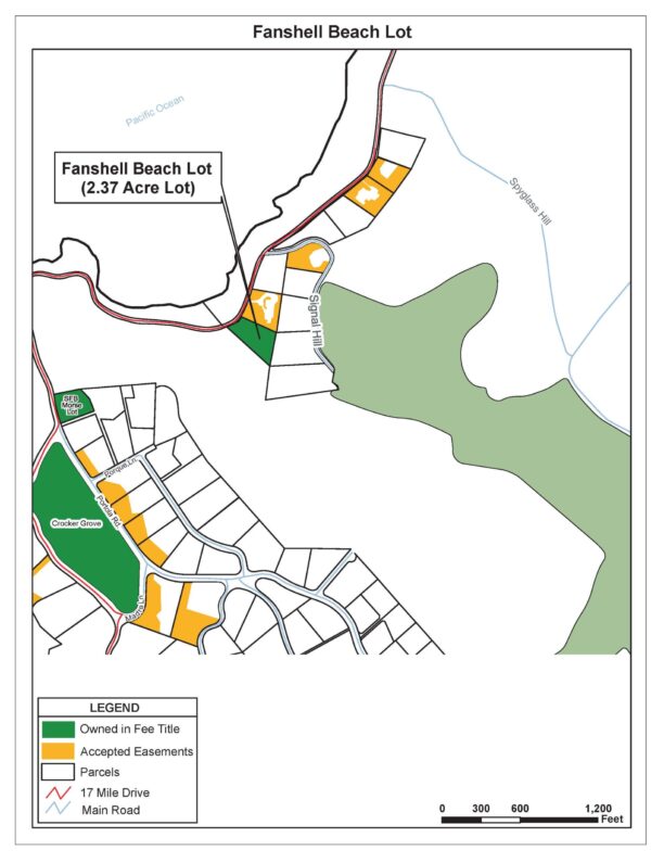
Fanshell Dunes Property
Fanshell Dunes Property– 2.37 Acres
OSAC Category: VI, Golf Course – preservation of habitat value and diversity of nearby natural areas
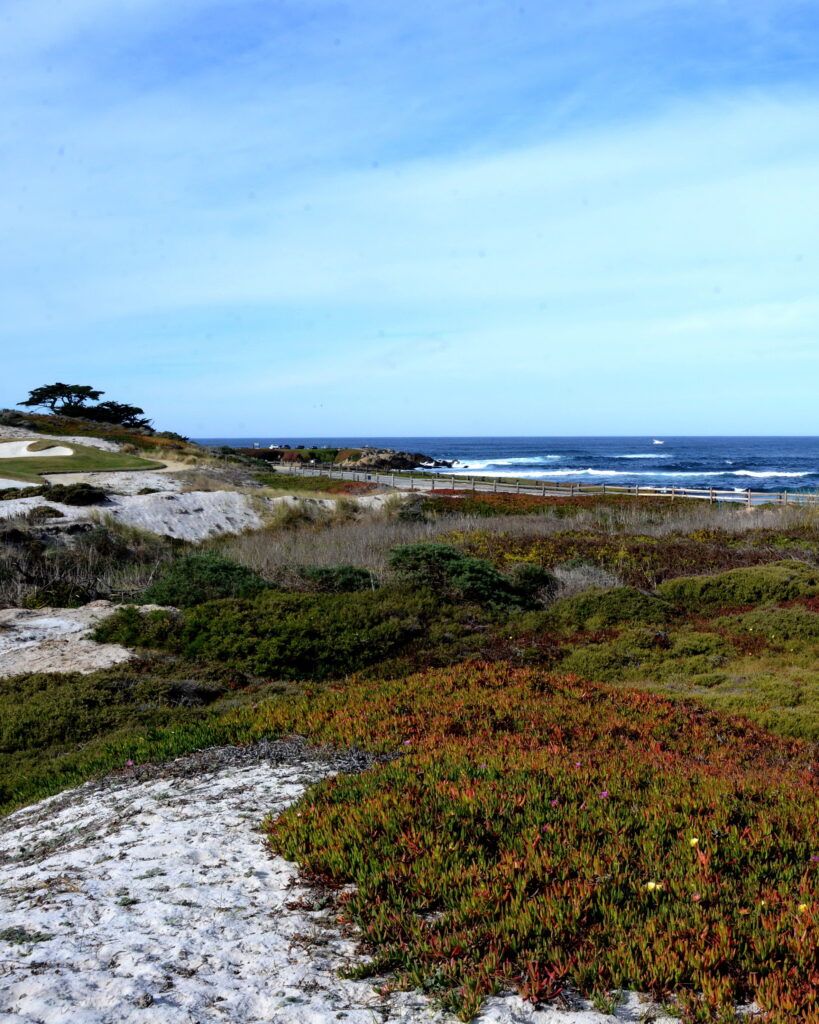
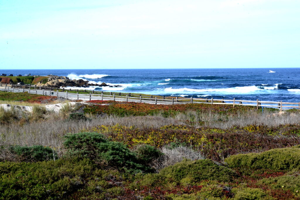
The Fanshell Dunes Property is undeveloped dune habitat located near Cypress Point and is bounded by 17 Mile Drive and Cypress Point Golf Course on the west and south, and residential lots to the north and east.
The property was purchased by Del Monte Forest Conservancy (DMFC) on December 28, 2012 using donations received from Pebble Beach property owners designated specifically for the purchase. DMFC granted a scenic and conservation easement to Cypress Point Golf Club on February 1, 2013, prohibiting development, public access and limiting use to natural open space for habitat protection and the prevention of disturbance to native ground cover. Much of the property is covered by ice plant. DMFC is removing this invasive non-native species and replanting the affected areas with native vegetation.